Google Maps Borders
Research, 2019
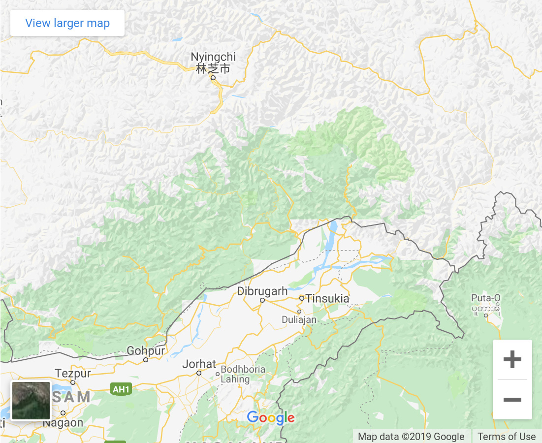
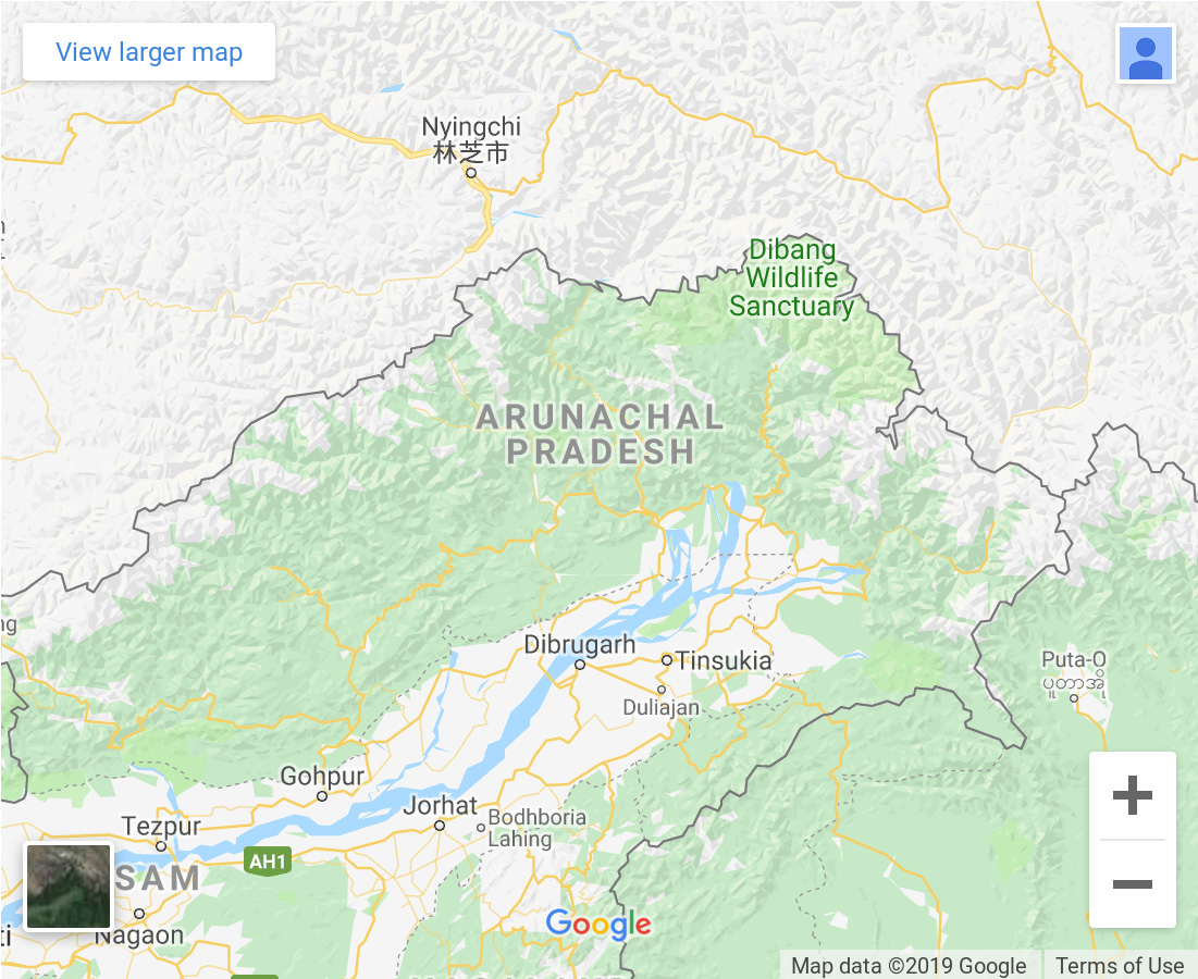
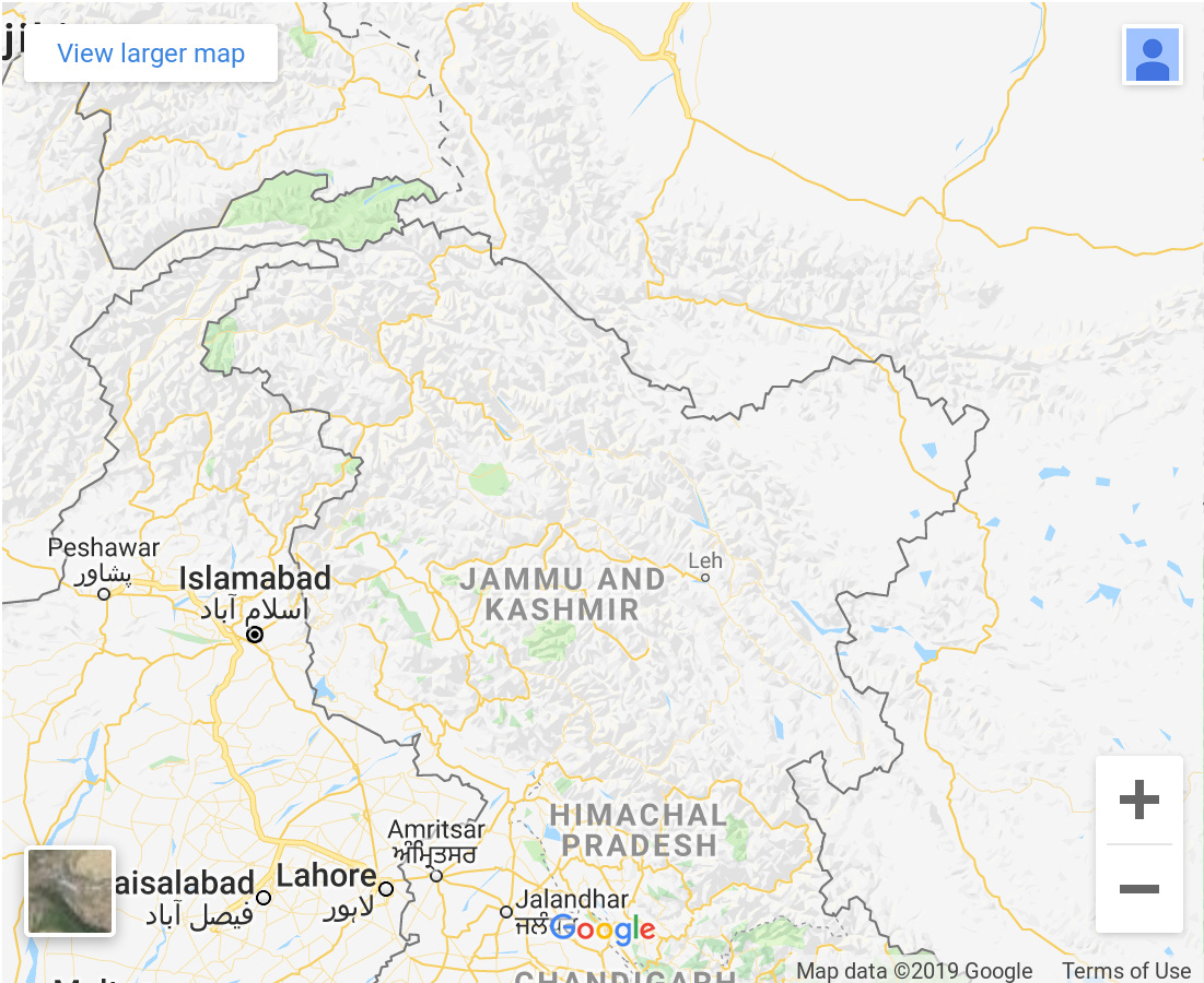
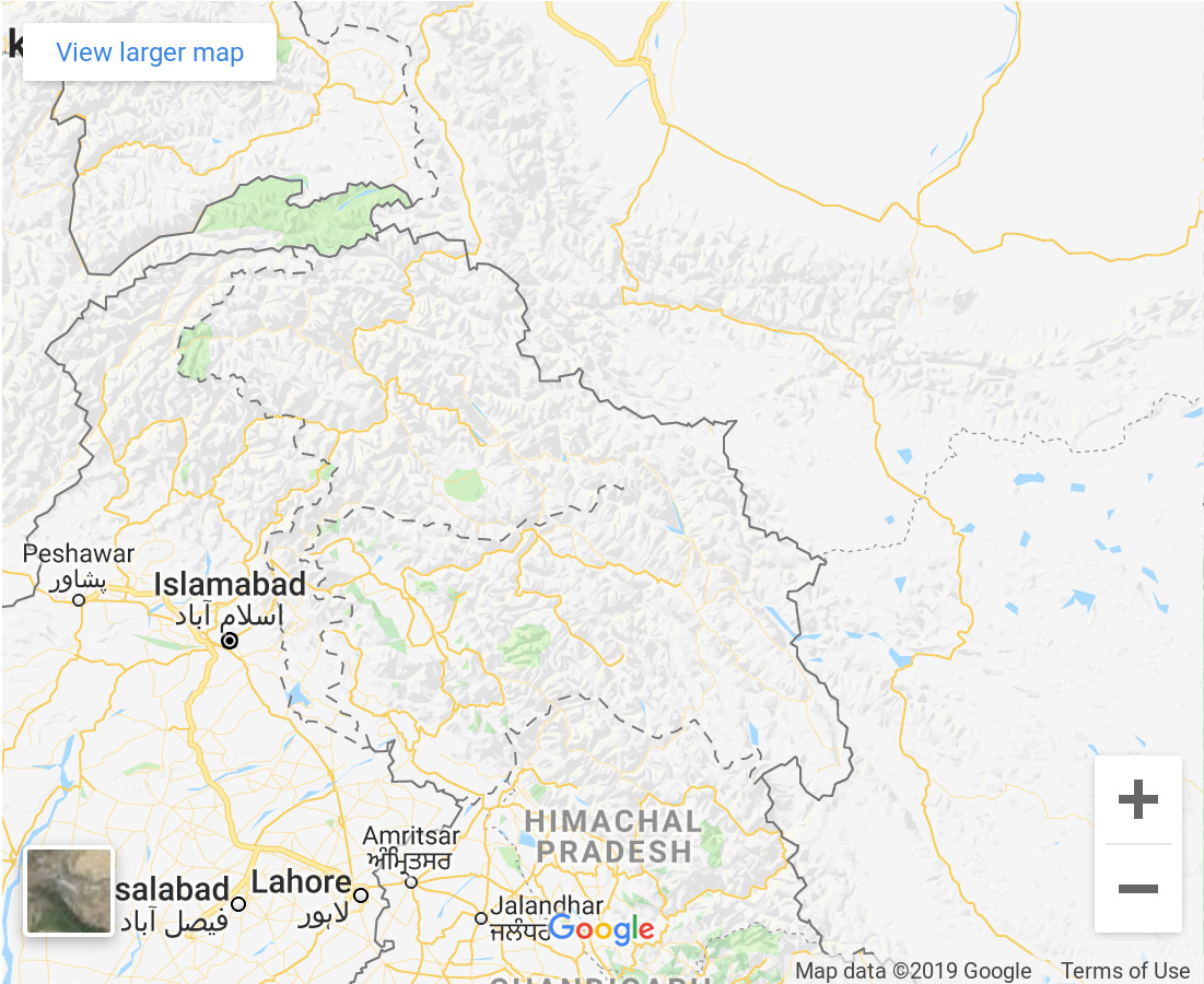
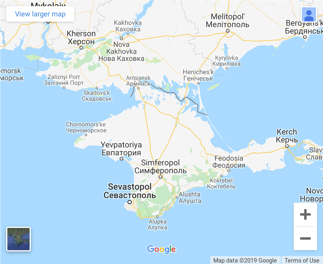
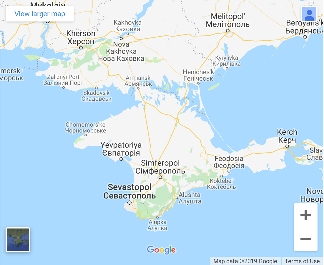
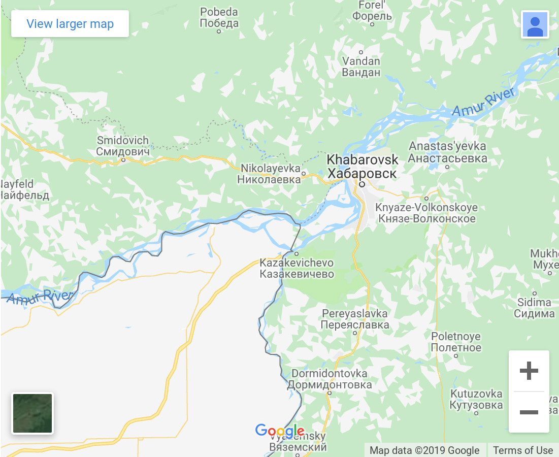
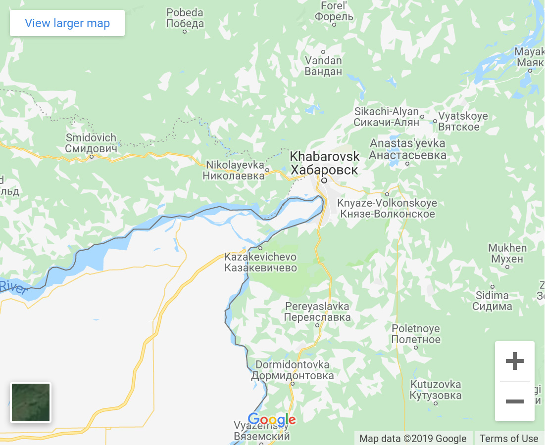
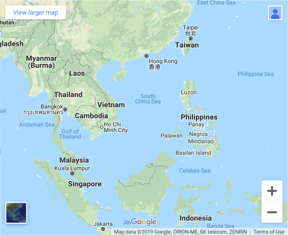
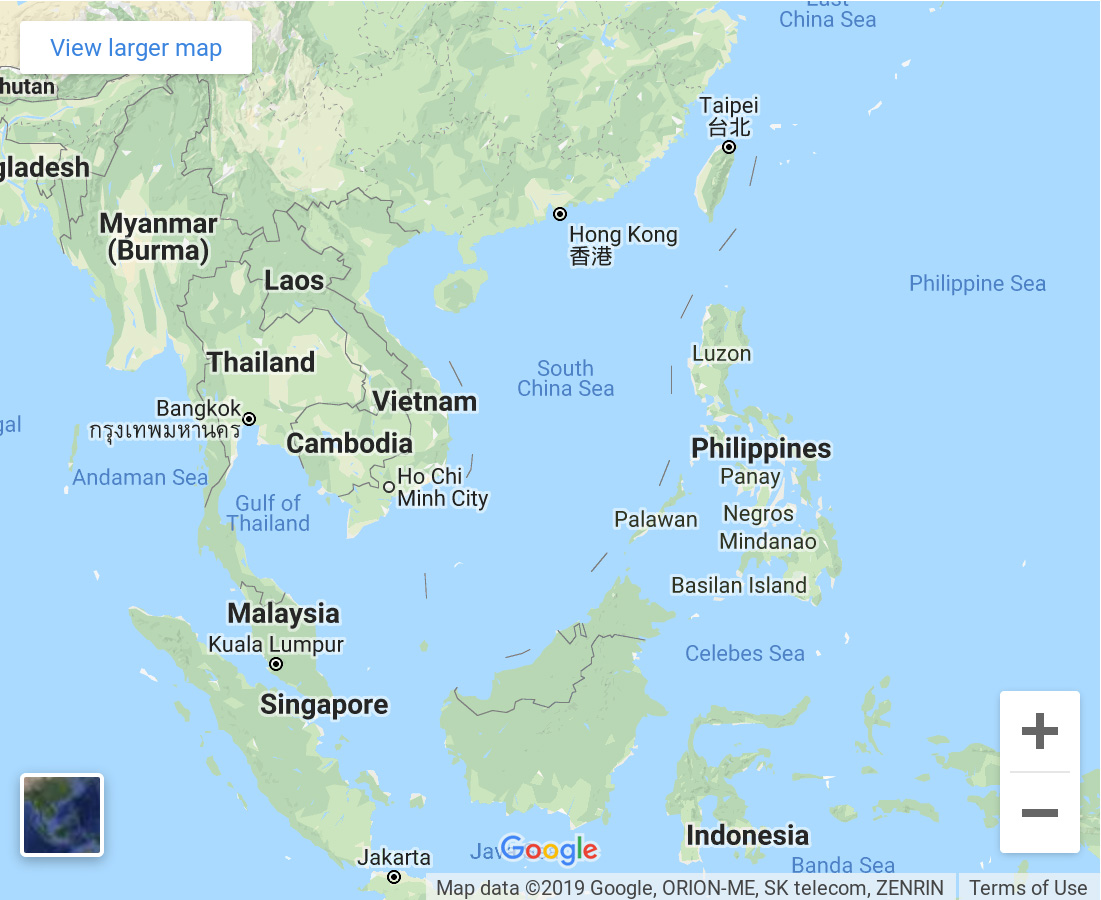
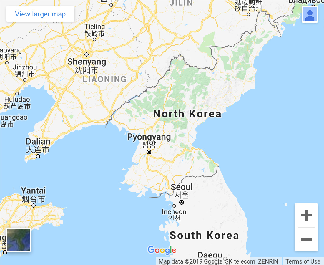
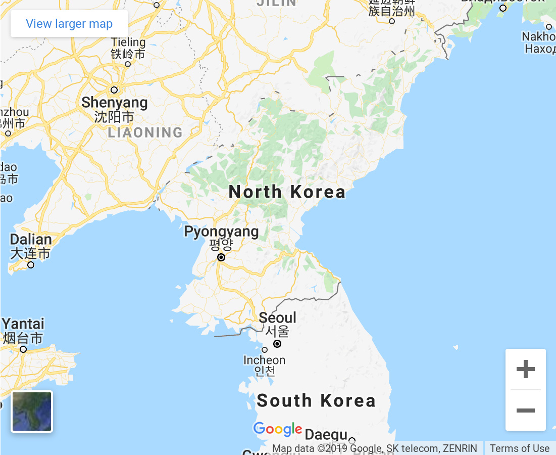
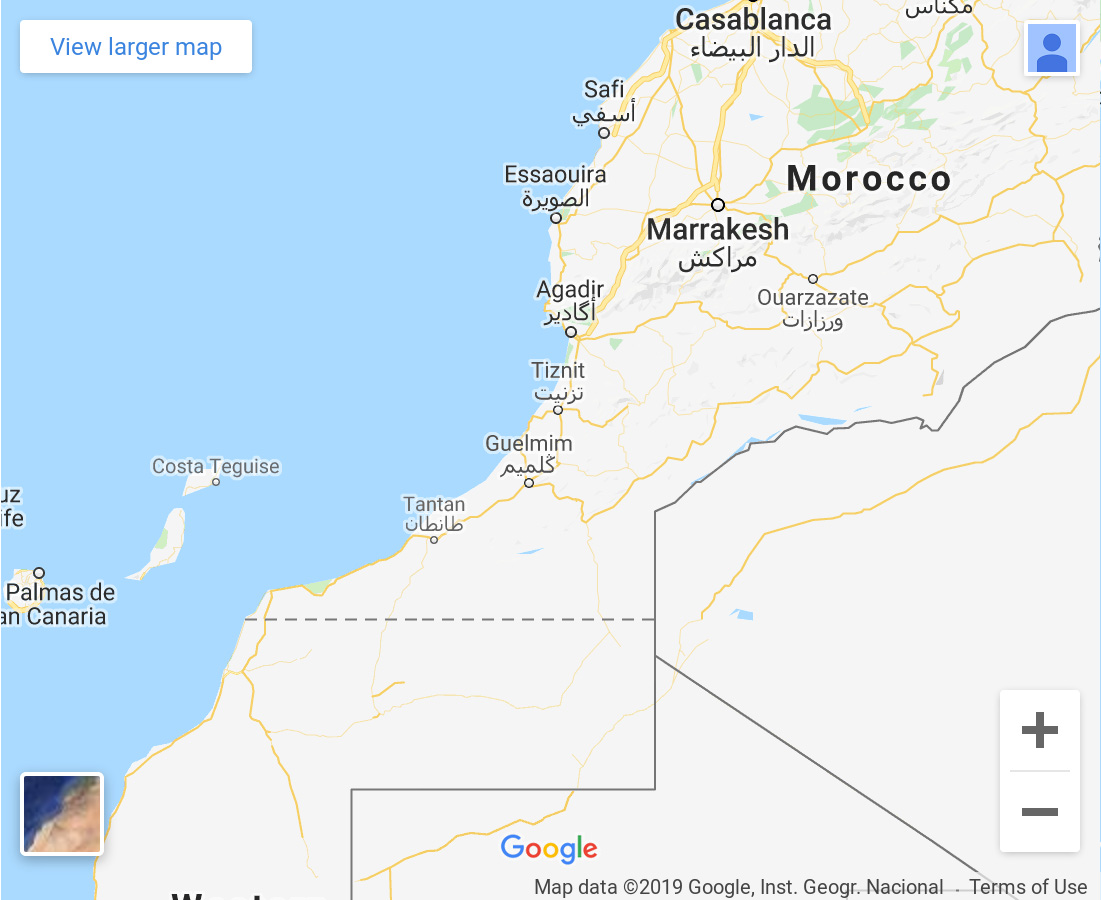
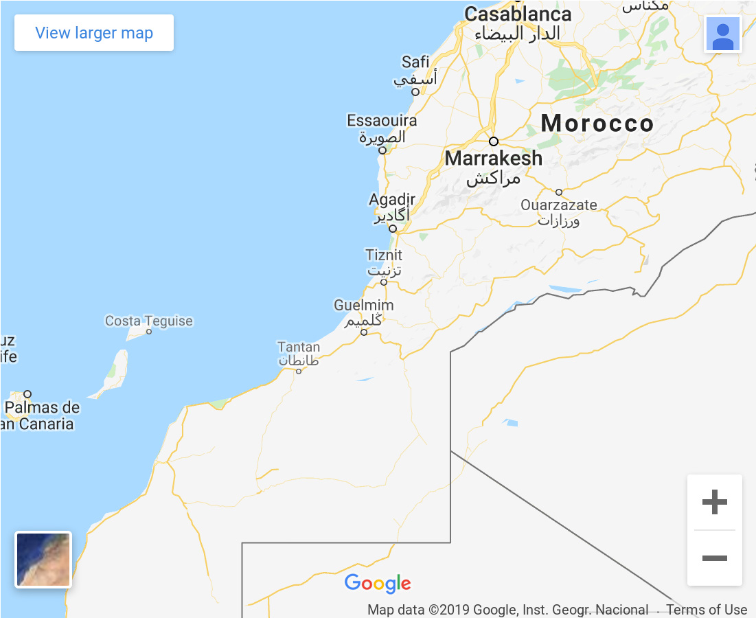
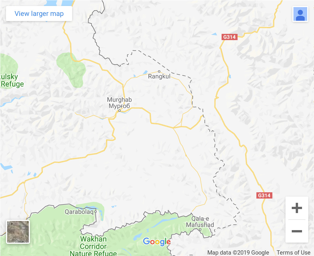
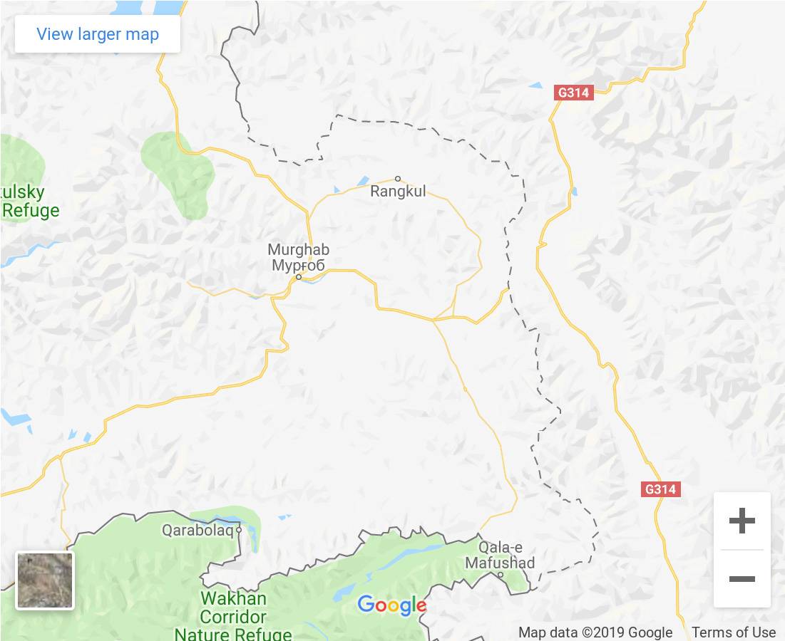
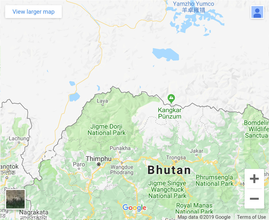
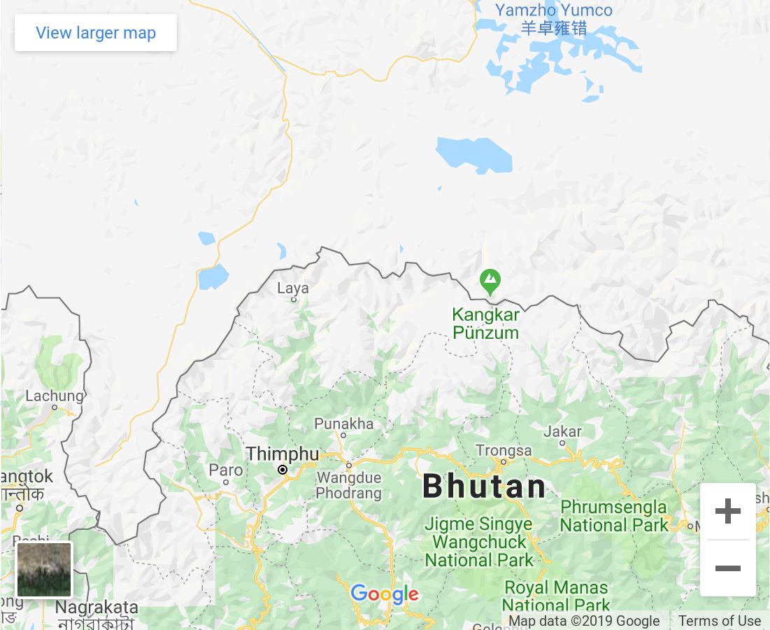
Introduction Maps have always been used to push influences or represent interests. With maps it is possible to enforce truth claims of knowledge under specific conditions, which are closely interwoven with power. They are a substitute for political and military power that is under the control of territories of state borders. Through the advent of online services such as GoogleMap, a production method has been developed, which allows to update and react in real-time without high financial effort. As a result, geographic atlases flipping side by side have been replaced by maps that look like a seemingly invisible skin over the surface of the earth and can be accessed by smartphones from anywhere in the world.In these services, it can be noted that the national boundaries are represented differently by some countries, depending on which "google" the respective country is observed.This shows how the company "Google" supports the view of the respective regional government in order not to lose the local market for online map services. This raises the question of the influence of the map producer on the one hand. And on the other hand, that maps can create reality and thus reflect authoritarian images without us being aware of it. Thus, maps are not only projections of spatial knowledge, but also images of the world and, above all, intentions that we follow with mapping.